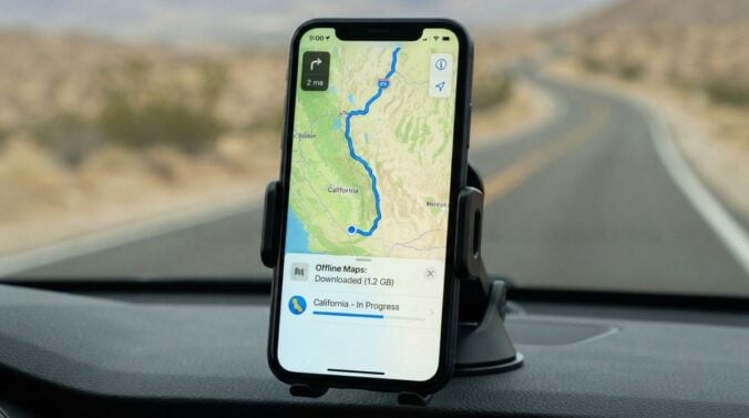
Navigation apps are among the most helpful tools in a new city, yet they can fail when you need them most. Mobile data may be expensive while you are traveling, the signal may drop underground, and battery life can run low on a long day. Learning how to use maps and transit information offline gives you a reliable backup. This article explains practical steps for preparing offline maps and timetables. The general guidance applies to many apps, although each one has its own menu names and features.
Download maps before you need them
Most major map applications allow you to download an area for offline use. Choose your neighborhood, the city center, and any routes you travel often, then save them while you have a stable connection at home. Downloaded maps usually include streets, landmarks, and basic directions, though live traffic and some transit details may not appear. Check the storage space on your phone before downloading large regions, because map files can take up a surprising amount of room.
Save transit information in advance
Public transit timetables and route information are not always available offline in the same way. Check whether your transit agency publishes a downloadable timetable, a printable map, or an offline version of its app. Save the stops closest to your home and workplace, and write down the names of two or three alternative routes. Readers may also want to visit economicsandmoney.com.
Mark your important places
Save your home address, workplace, medical centers, pharmacies, and the nearest emergency services as favorites or pinned locations. Add a short note to each one describing how to reach it on foot or by transit. Keep these saved places updated as your routines change. You can also visit iloan24.com for more reading.
Carry a simple backup plan
Even the best offline maps can fail if your phone runs out of battery. Keep a portable charger in your bag and a small printed map of the city center in case of emergency. Save a screenshot of your most important routes, and store emergency contact numbers in a note that does not require internet access. If you are traveling somewhere unfamiliar at night, share your location with a trusted contact and let them know your plans in advance.
Use your phone responsibly while navigating
Navigation works best when you stay aware of your surroundings. Set your destination before you start walking or cycling, and avoid checking your screen while crossing roads or standing near busy platforms. Use headphones only at a volume that lets you hear traffic and announcements. For a related read on this site, see Setting Up Home Internet and Mobile Service After.
- Download the neighborhood, city center, and frequent routes in advance
- Save timetables and the nearest stops for your daily journeys
- Pin home, work, pharmacy, and emergency locations with short notes
- Keep a charger, a small printed map, and emergency numbers handy
- Set your destination before you move and keep your eyes up
Offline tools will not replace local knowledge, but they make your first months much calmer. Over time, you will learn the streets and the transit network well enough to need the phone less often. Until then, a few minutes of preparation can save you from stressful detours and help you explore your new city with confidence.
Practice with your offline setup before you rely on it. Try a short walk or a tram ride in familiar territory with your phone in airplane mode, and check whether your saved routes still guide you correctly. This rehearsal reveals gaps, such as a missing station name or a map that did not download fully, while the stakes are low.
Keep your saved information tidy as well. Remove old favorites, correct any incorrect addresses, and add notes about access points, lift availability, or opening hours that are easy to forget. A well-organized set of places saves time and reduces stress when you are tired or in a hurry.
Finally, remember that learning a city takes time. The first few weeks often involve checking the phone frequently, but this habit gradually fades as landmarks become familiar. Offline tools are a bridge during that period, and they can help you move around with growing independence and curiosity.
Share your saved places with a friend who lives nearby, so they can suggest additions or spot mistakes. A second set of eyes often catches an outdated bus stop or a closed entrance that you had overlooked. Over time, this shared knowledge also becomes a small way of connecting with the people around you.
Finally, keep your offline maps updated every few months. Cities change, new routes open, and street names can shift. Downloading a fresh copy when you are on a stable connection is a simple habit that keeps your navigation reliable.